FieldBaseline Studies
Version: 1.0.1
32.00MB
4.5


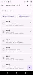

FieldBaseline Studies is a mobile data collection tool built for researchers, NGOs, and field teams who need reliable baseline survey capture in remote and urban environments. It consolidates GPS-enabled observations, customizable forms, photos, and offline syncing into a structured workflow for repeatable, audit-ready datasets.
FieldBaseline Studies bundles practical features to streamline field operations. The app offers a visual form builder so teams can create surveys with conditional logic, validation rules, and multimedia prompts. GPS logging and geofencing ensure every record carries spatial context, while automatic timestamping and device metadata support traceability. Offline-first caching lets data be collected without continuous connectivity, and a background sync engine reconciles records when a connection becomes available.
The application focuses on real-world fieldwork patterns: define a project template, deploy it to a team, collect data, review entries, and export a validated dataset. You can run repeat baseline visits, compare longitudinal records, and tag observations by activity or site. FieldBaseline Studies supports branching surveys so enumerators only see relevant questions, reducing errors and speeding up interviews.
Usability is central to the design. The interface uses clear visual cues for required fields, validation errors, and offline status. The form editor supports a range of input types: text, numeric, single- and multi-select, date/time pickers, photo and audio capture, and sketches. Form templates can be duplicated and adapted for different projects, and preview mode lets managers test forms on-device before rollout.
Geospatial functionality is built in: collect point locations, draw polygons, and attach tracks to survey records. Map layers can display base maps and custom shapefiles, allowing teams to visualize sample distributions and verify site boundaries. FieldBaseline Studies also supports exporting collected geometry as GeoJSON or KML for use in desktop GIS software.
Data governance is straightforward. Records are stored locally with an encrypted cache and synchronized to a central server or cloud storage when connectivity is available. Administrators can export datasets in common formats such as CSV, XLSX, and GeoJSON, and attachments (images, audio, sketches) are bundled with exports. Change logs and revision histories make audits and quality checks easier.
FieldBaseline Studies includes role-based access so project leads, enumerators, and analysts have appropriate permissions. Team assignments and project-specific user groups make it simple to control who can edit forms, view raw data, or trigger exports. Built-in commenting and record-level review workflows accelerate QA without moving data out of the system.
The app is optimized for Android devices and aims to perform on low-end hardware commonly used in fieldwork. It minimizes battery use by controlling GPS polling intervals and batching network requests. Offline performance is prioritized: local queries remain fast even with thousands of collected records, and the sync process is designed to resume gracefully after interruptions.
Security features include encrypted local storage, TLS for network transfers, and configurable data retention policies. Sensitive fields can be masked or restricted to users with higher privileges. Audit trails record who accessed or edited records and when changes were made, supporting compliance with project-specific privacy requirements.
To begin, install FieldBaseline Studies on your device, create a project, and use the form builder to design your first survey. Deploy the form to team devices, perform a dry run in preview mode, then begin field collection. Use the dashboard to monitor submission status and trigger exports when ready. The app’s built-in help and templates speed onboarding for new enumerators.
FieldBaseline Studies is built to simplify baseline data collection while preserving data quality and auditability. Its combination of offline reliability, spatial tools, and customizable forms makes it a practical choice for teams conducting surveys across diverse environments.