CityScope
Version: 2.5.12
72.91MB
4


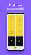

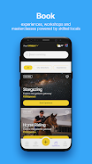

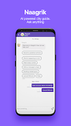
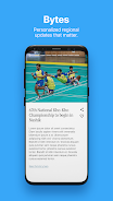
CityScope is a mobile urban planning and mapping tool that delivers layered maps, 3D visualization, and on-device analytics for Android users, enabling planners, architects, and field teams to inspect infrastructure, simulate development scenarios, and capture site observations with or without an internet connection.
CityScope bundles an approachable interface with professional-grade mapping tools. Import common GIS formats, overlay custom data layers, toggle building footprints and land-use tiles, and visualize traffic and demographic heatmaps. The app supports both raster and vector tiles, offers an offline cache for fieldwork, and includes measurement tools for accurate distance and area calculations.
The layout focuses on quick access to essential tasks: layer management, navigation, and annotation. A collapsible sidebar keeps map tools within reach while maximizing screen space for 3D and 2D views. Contextual menus change depending on selected layers or features, and gestures on touchscreens provide intuitive zoom, rotate, and tilt controls. CityScope’s workflow guides users from data import to analysis and export with minimal friction.
CityScope is designed to fit into existing toolchains. It reads GeoJSON, Shapefile packages, KML, and common raster formats, plus it can connect to WMS/WMTS and tile servers for live basemaps. For teams that rely on desktop GIS, the app exports standardized files that preserve attribute tables and geometry, allowing edits made on the device to be reconciled back into central datasets.
Visualization options include multi-band color ramps, choropleth shading, and elevation-based extrusion for quick visual assessment of building heights or terrain. Built-in analysis tools perform buffering, intersection tests, and catchment estimations directly on the device. Lightweight modeling features let users simulate land-use changes and view projected shadow patterns from proposed structures in a simple, shareable format.
CityScope includes configurable project templates for zoning review, transportation planning, and site assessment. Administrators can predefine symbology, layer order, and report fields so every team member starts with consistent visuals. For advanced users, custom scripts and styling rules can be applied to automate coloring or to derive new attributes from existing data.
Capture photos, voice notes, and geotagged inspections directly inside CityScope. Field teams can mark up maps with pins and polygons, assign task statuses, and sync changes to a shared cloud workspace when connectivity is available. The app supports role-based permissions and a simple audit trail so managers can track who made edits and when.
CityScope is optimized to run smoothly on mid-range Android devices while taking advantage of high-end hardware for faster rendering and larger offline caches. Tile streaming and on-demand vector simplification reduce memory use, and background synchronization minimizes battery drain. The app supports Android versions commonly used in enterprise deployments and integrates with device location services for accurate GPS positioning.
Data security is built in through optional encrypted storage, secure connections to remote servers, and local-only workflows for sensitive projects. CityScope provides administrators with settings to restrict exports, enforce passcodes, and limit third-party data sharing to meet organizational policies.
New users can begin with sample projects that demonstrate mapping, analysis, and reporting features. Import a small GeoJSON to test layer controls, create a simple buffer analysis, and try exporting a PDF report to see how field observations become shareable documents. Tutorials and in-app help walk through common tasks so teams can adopt CityScope quickly without a steep learning curve.
CityScope fits municipal planners, transportation analysts, real-estate professionals, and community groups that need reliable mapping tools on mobile devices. Its balance of simplicity and technical depth makes it suitable for short site visits as well as longer analytical projects where GIS-grade accuracy and documentation are required.